Kimberley Local
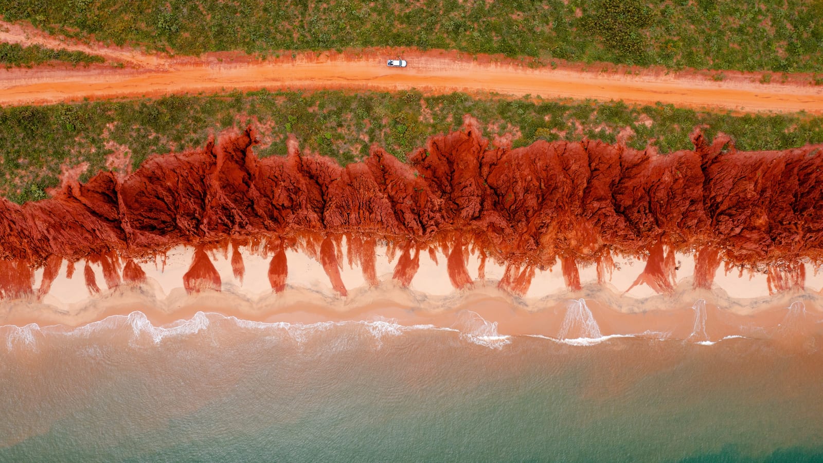
Cape Leveque — red cliffs and turquoise water, Dampier Peninsula
Local's Guide

Dampier Peninsula

Red cliffs, turquoise water, Aboriginal communities and some of the most remote coastline in Western Australia — just north of Broome.

Many destinations on the Dampier Peninsula are on Aboriginal land. Always check permit and access requirements before travelling. Do not enter communities without permission.

The Cape Leveque Road is now sealed, but access roads to individual destinations may be unsealed or require a 4WD. Check conditions with Main Roads WA (mainroads.wa.gov.au) before travelling, especially after rain.

Fuel is available at limited locations. Plan your fuel stops carefully and carry extra if travelling long distances.

The Dampier Peninsula — Broome's wild backyard

The Dampier Peninsula stretches about 200 km north of Broome, ending at Cape Leveque — a dramatic headland where the Indian Ocean meets the Timor Sea. The peninsula is home to several Aboriginal communities and some of the most spectacular coastal scenery in Australia.

The main road — the Cape Leveque Road — is now sealed all the way to Cape Leveque. However, access roads to individual destinations along the way may be unsealed, sandy or require a 4WD. Check conditions for each specific destination before you travel, and confirm whether your hire vehicle is permitted on unsealed roads.

Many destinations are on Aboriginal land — check access requirements, permits and community protocols before you travel.

Destinations

Cape Leveque / Kooljaman (CLOSED)

Cape Leveque / Kooljaman (CLOSED)

Where two oceans meet at the tip of the peninsula

Cape Leveque is the northern tip of the Dampier Peninsula — a stunning headland with white sand beaches on one side and red cliffs on the other. Kooljaman at Cape Leveque is an Aboriginal-owned wilderness camp. Check current operating status and availability directly with Kooljaman before planning your visit.

~220 km north of Broome (approx. 3–4 hours)
Approximately 220 km north of Broome. The Cape Leveque Road is sealed. Access roads to specific areas at Cape Leveque may be unsealed — check current conditions before travelling.
Permits: No permit required to visit Cape Leveque. Kooljaman is on Bardi Jawi land — respect community protocols.
Cygnet Bay Pearl Farm

Cygnet Bay Pearl Farm

Australia's oldest working pearl farm

Cygnet Bay is home to Australia's oldest working pearl farm, operated by the Brown family since 1946. Tours of the farm are available, and the bay itself is beautiful. Accommodation and camping are available on site. The farm is about 180 km north of Broome.

~180 km north of Broome
The Cape Leveque Road is sealed; the access road to Cygnet Bay may be unsealed. Check current conditions and confirm your hire vehicle is permitted. Bookings required for tours and accommodation.
Permits: Private property — access is through the farm. Book ahead.
Beagle Bay

Beagle Bay

A remarkable pearl-shell church in a remote community

Beagle Bay is an Aboriginal community about 120 km north of Broome, home to the Sacred Heart Church — a remarkable building decorated with pearl shells, built by Pallottine missionaries in the early 1900s. The church is open to visitors at certain times. Beagle Bay is a community — visitors should be respectful and follow community protocols.

~120 km north of Broome
Approximately 120 km north of Broome. The Cape Leveque Road is sealed; the access road to Beagle Bay may be unsealed. The community has a small store.
Permits: Entry permit required to enter the community. Contact the Beagle Bay Community for current requirements.
Barred Creek & Quondong Point

Barred Creek & Quondong Point

Coastal day trips on the Manari Road

The Manari Road runs west from the Cape Leveque Road, giving access to a series of beautiful coastal spots including Barred Creek and Quondong Point. These are popular day trips from Broome — bring your own food and water, as there are no facilities. The Manari Road is unsealed and a 4WD is recommended.

Barred Creek ~80 km from Broome
4WD recommended for the Manari Road. No facilities at the beaches. Carry plenty of water.
Permits: Check current access requirements — some areas are on Aboriginal land.

Not sure where to start on the Dampier Peninsula?

We can help you plan a day trip or overnight adventure that suits your vehicle and experience.

Ask a Local

Closer to Broome? See our day trips guide

Coconut Well, Barred Creek, Quondong Point and James Price Point — coastal day trips on the Manari Road corridor, with access notes and tidal information.

Day trips guide